Pateley Bridge Walks
At the heart of Nidderdale Area of Outstanding Natural Beauty, Pateley Bridge offers access to some of Yorkshire's most spectacular walking country.
From challenging moorland hikes to gentle riverside strolls, these five routes showcase the region's diverse landscapes - where ancient dry-stone walls trace paths across heather-clad hills, historic reservoirs mirror dramatic skies, and centuries-old villages preserve Yorkshire's rural heritage.
Whether you're looking to conquer the 54-mile Nidderdale Way or enjoy a peaceful walk along the River Nidd, these carefully selected trails offer the best ways to explore this remarkable corner of Yorkshire.
Exploring Pateley Bridge and Its Scenic Trails
Pateley Bridge offers spectacular walking opportunities through historic landscapes and natural beauty, nestled within the protected Nidderdale Area of Outstanding Natural Beauty in North Yorkshire.
Overview of Pateley Bridge
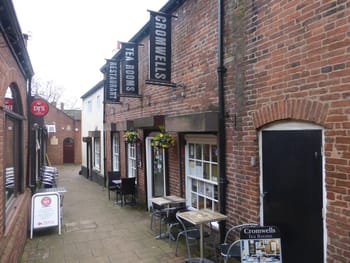
Pateley Bridge's rich heritage spans centuries of industrial and cultural development, making it an ideal base for exploring Yorkshire's countryside.
The town centre features charming stone buildings and well-marked footpaths that connect to numerous walking routes.
Local amenities include several pay-and-display car parks and public toilets.
The Pateley Bridge Heritage Trails showcase the town's evolution through time, with routes suitable for different abilities.
Significance of Nidderdale AONB
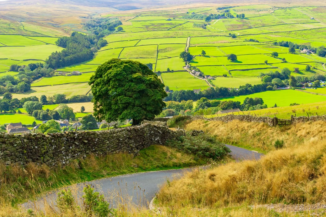
The Nidderdale landscape demonstrates centuries of human influence whilst maintaining its natural splendour.
Ancient dry-stone walls and historic field patterns create a distinctive character across the hills.
The area includes notable features like Coldstones Cut, which provides views of Yorkshire's last working quarry.
Three charming villages - Middlesmoor, Stean and Lofthouse - can be explored via the Nidderdale Way, offering authentic Yorkshire experiences.
The protected status ensures the preservation of both natural habitats and cultural heritage, maintaining the area's unique character for future generations.
The Nidderdale Way: A Premier Walking Route
The 54-mile Nidderdale Way circles through Yorkshire's hidden gem, featuring dramatic moorland vistas and peaceful riverside paths.
This well-maintained trail starts and ends in Pateley Bridge, offering varied terrain suitable for different walking abilities.
Route Highlights
The trail winds through diverse landscapes, from steep valley sides to rolling farmland.
The complete circuit typically takes 4-7 days, depending on pace and chosen itinerary.
The path follows the River Nidd through picturesque villages and historic sites.
Many accommodation providers offer luggage transfer services for multi-day walks.
Walkers need the Ordnance Survey Explorer 298 map covering Nidderdale, Fountains Abbey, Ripon and Pateley Bridge.
The trail features clear waymarking throughout most sections.
Circular Walks and Extensions
The Pateley Bridge circular walk offers a perfect introduction to the area.
Starting from the South Car Park, this route follows sections of the Nidderdale Way with clear signposting.
The Victorian Gardens Trail presents a shorter 3.75-mile option, showcasing historic houses and gardens around Pateley Bridge.
This moderate difficulty walk takes 2-3 hours to complete.
Additional circular routes branch off the main trail, allowing walkers to explore specific areas of interest while returning to their starting point.
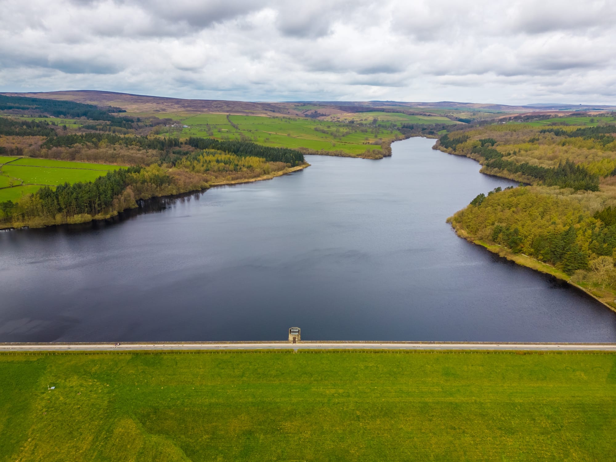
Natural Wonders: Reservoirs and Geology
The Yorkshire Dales' dramatic landscape features magnificent reservoirs nestled among limestone formations, whilst ancient industrial sites reveal the area's rich geological heritage.
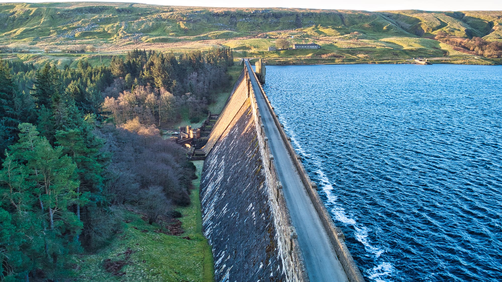
The Dramatic Scar House Reservoir
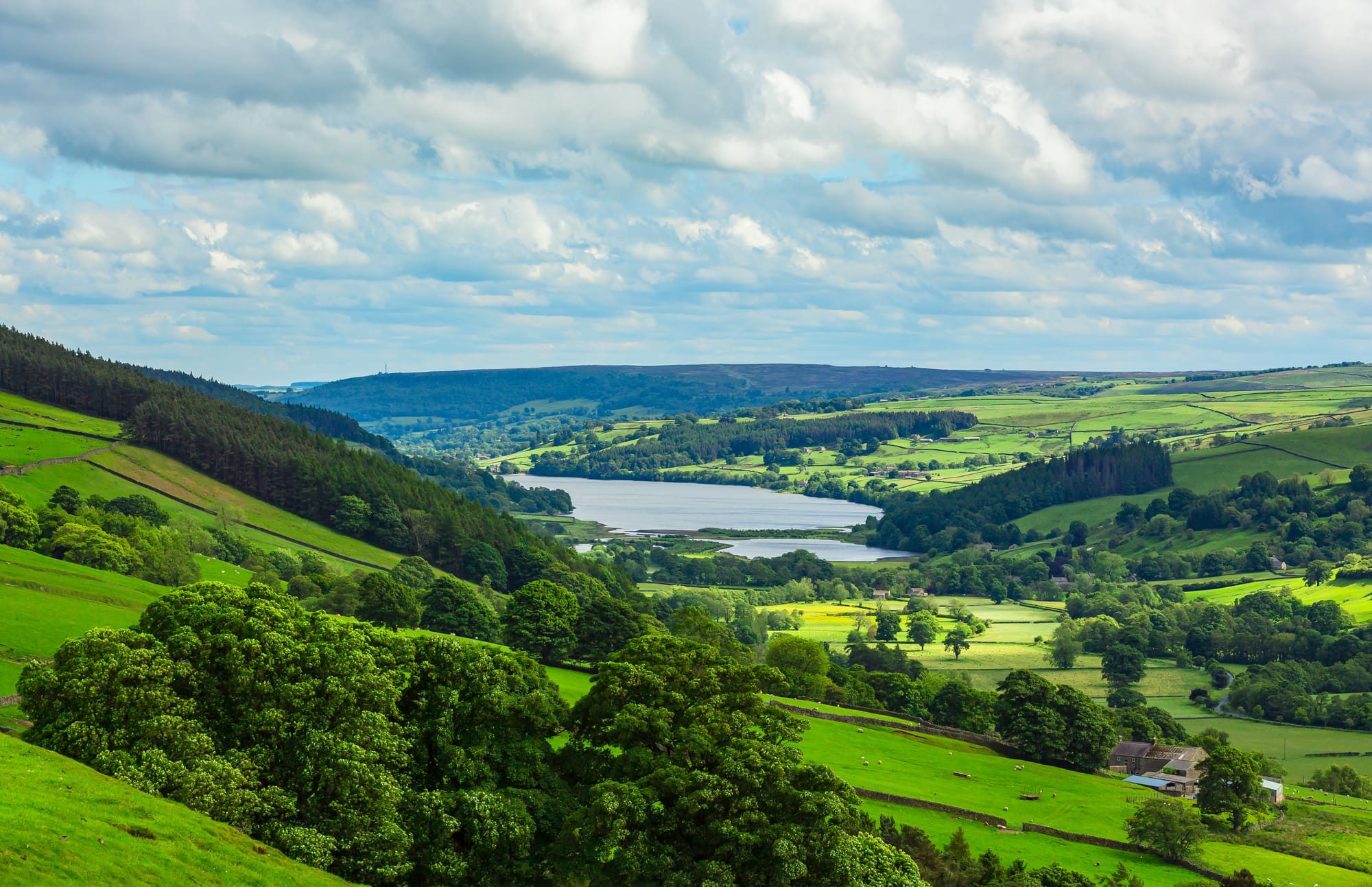
Scar House Reservoir sits at 325 metres above sea level in Upper Nidderdale, surrounded by steep valley sides.
Built between 1921 and 1936, it comprises a massive 71-metre-high dam that holds back 2.2 billion gallons of water.
The reservoir's stone-built dam offers spectacular views across the water to the fells beyond.
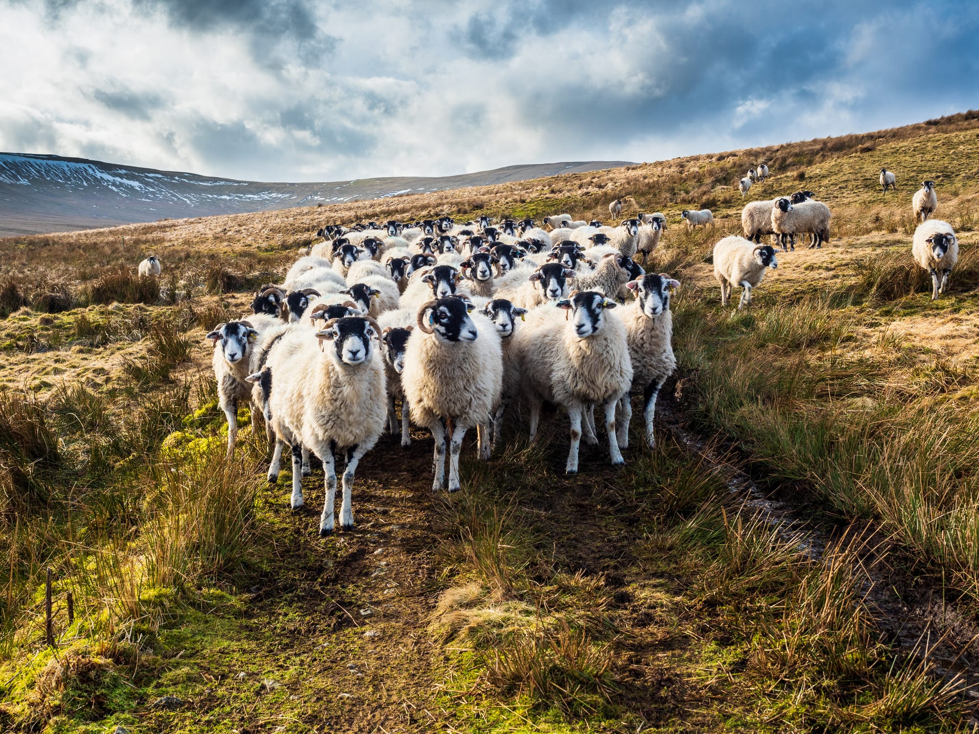
Red grouse and curlews frequent the heather moorland around its edges.
Walking routes circle the reservoir's 4-mile perimeter, with paths suitable for most abilities.
Spring and autumn provide the most dramatic views when morning mist often shrouds the water.
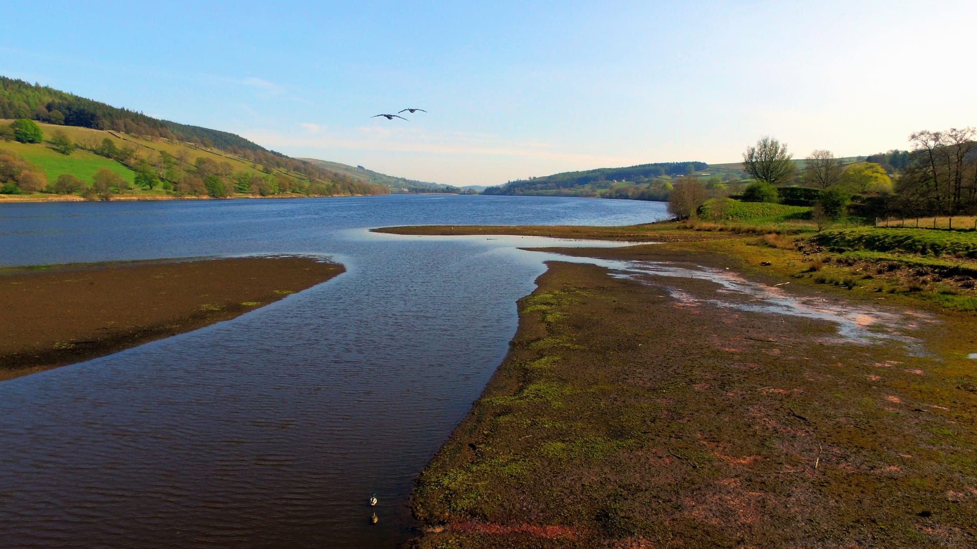
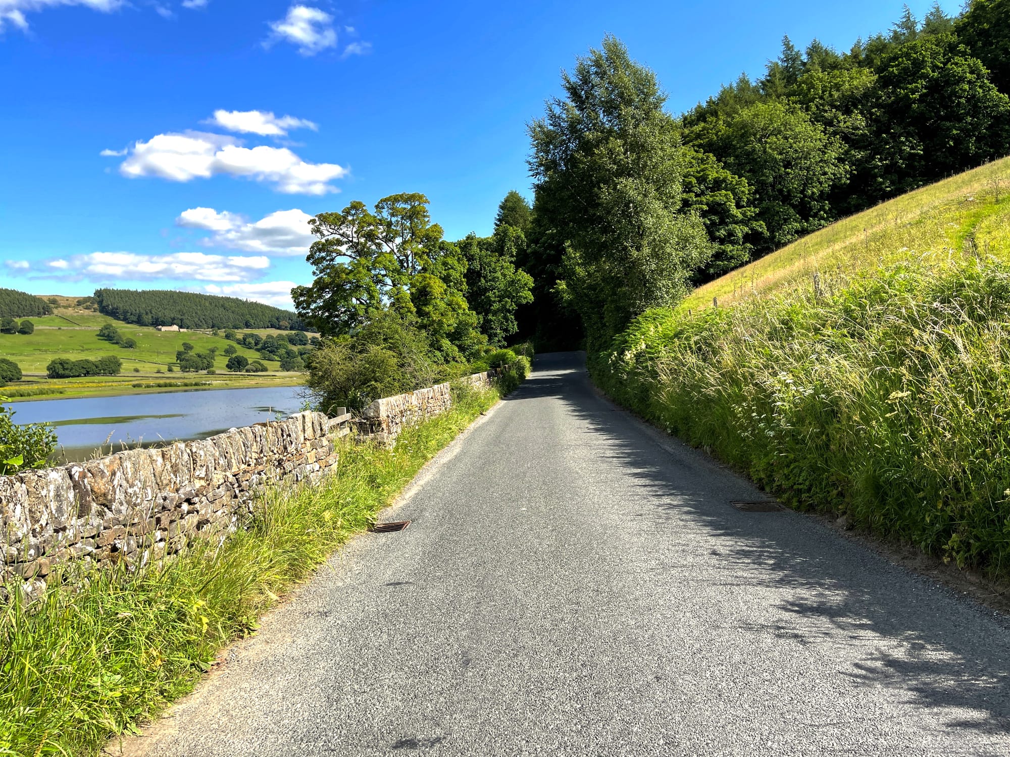
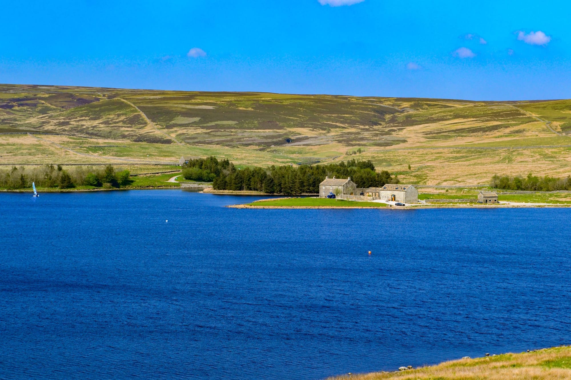
Gouthwaite Reservoir: A Wildlife Haven
Gouthwaite Reservoir near Pateley Bridge serves as a compensation reservoir, maintaining water levels in the River Nidd.
Its peaceful waters attract diverse birdlife throughout the year.
The nature reserve surrounding the reservoir provides essential habitat for waterfowl and waders.
Keen birdwatchers can spot great crested grebes, goosanders and common sandpipers.
Public footpaths trace the eastern shore, offering excellent views across the water.
The western bank remains private but provides undisturbed sanctuary for wildlife.
Fewston Reservoir and Toft Gate Lime Kiln
Fewston Reservoir offers a gentle circular walk through woodland and along the waterside.
The well-maintained paths make it perfect for family walks in all seasons.
Near Greenhow village stands Toft Gate Lime Kiln, one of the best-preserved lime kilns in the region.
Built in the 1860s, it produced quicklime for agriculture and building works.
The Greenhow area showcases fascinating industrial heritage, with remains of lead mining visible across the landscape.
The Greenhow Geology Trail highlights the area's unique limestone formations and mineral deposits.
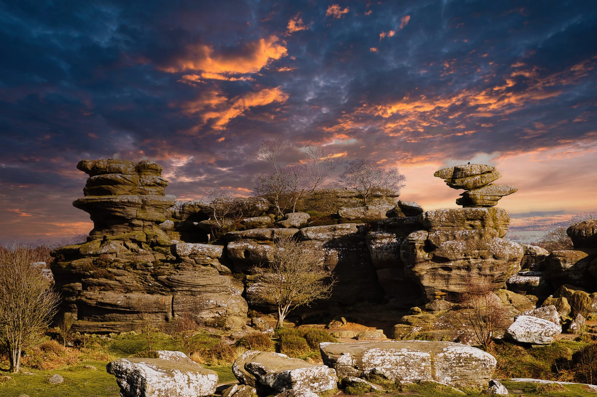
Brimham Rocks: An Icon of the Yorkshire Countryside
Brimham Rocks stands as one of Yorkshire's most distinctive natural landmarks, featuring dramatic rock formations sculpted by centuries of wind and weather.
These remarkable geological formations offer panoramic views across the stunning Yorkshire countryside, making them a prime destination for both photographers and nature enthusiasts.
Visitors can explore the area through a circular walking route that stretches approximately 5.6 kilometres.
The path winds through heather-clad moorland and showcases the raw beauty of the Yorkshire landscape.
The rocks are accessible via a scenic route from Pateley Bridge, creating a perfect 9-mile circular walk that combines natural splendour with glimpses of the region's industrial heritage.
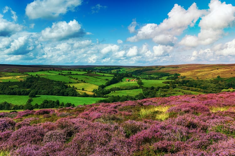
The surrounding moorland bursts into colour in late summer when the heather blooms, creating a purple carpet that contrasts beautifully with the weathered millstone grit formations.
Key Walking Routes Near Brimham Rocks:
- Glasshouses to Brimham Rocks riverside path
- Boundary circular walk
- Pateley Bridge to Brimham Rocks trail
- Nidderdale countryside exploration route